Paper
View all working papers
Working Paper
/ Jun 06,2023
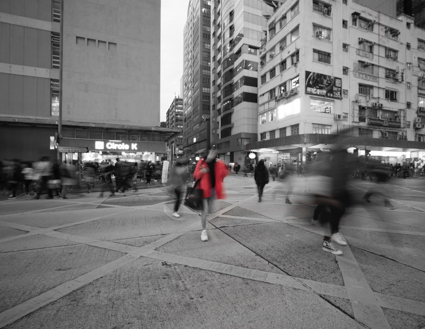
Take the Q Train
Value Capture of Public Infrastructure Projects
Paper
/ Apr 21,2021
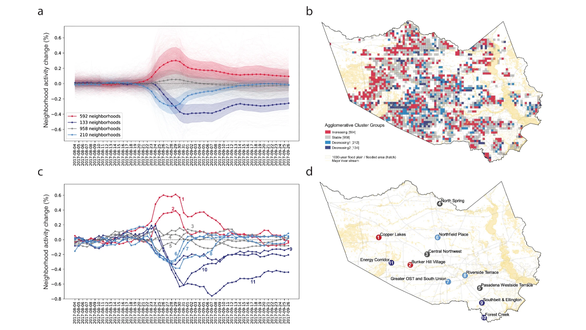
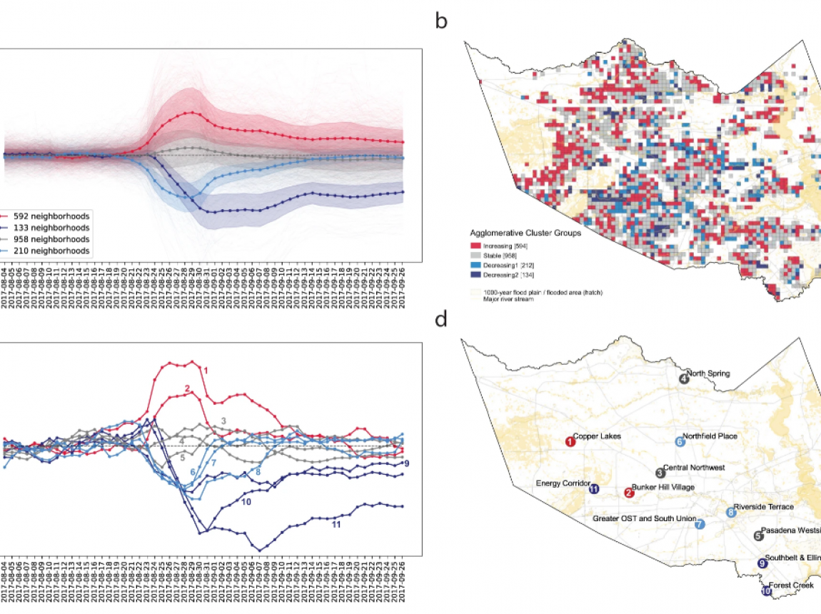
Inequality in Resilience to Natural Disasters
Using Large-scale Mobility Data as Measurement
Paper
/ Apr 06,2021
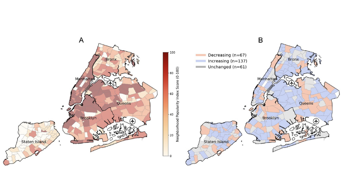
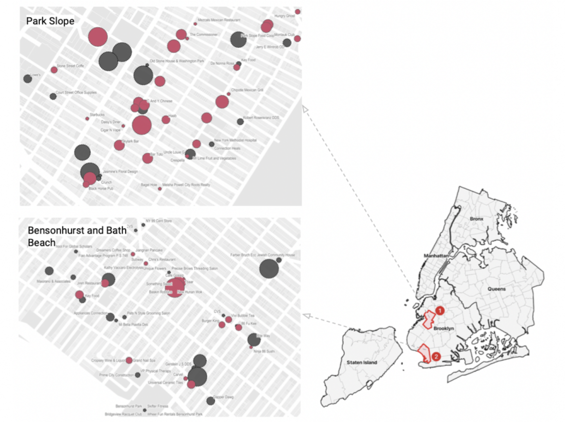
Up-and-Coming or Down-and-Out?
Social Media Popularity as an Indicator of Neighborhood Change
Paper
/ Mar 31,2021
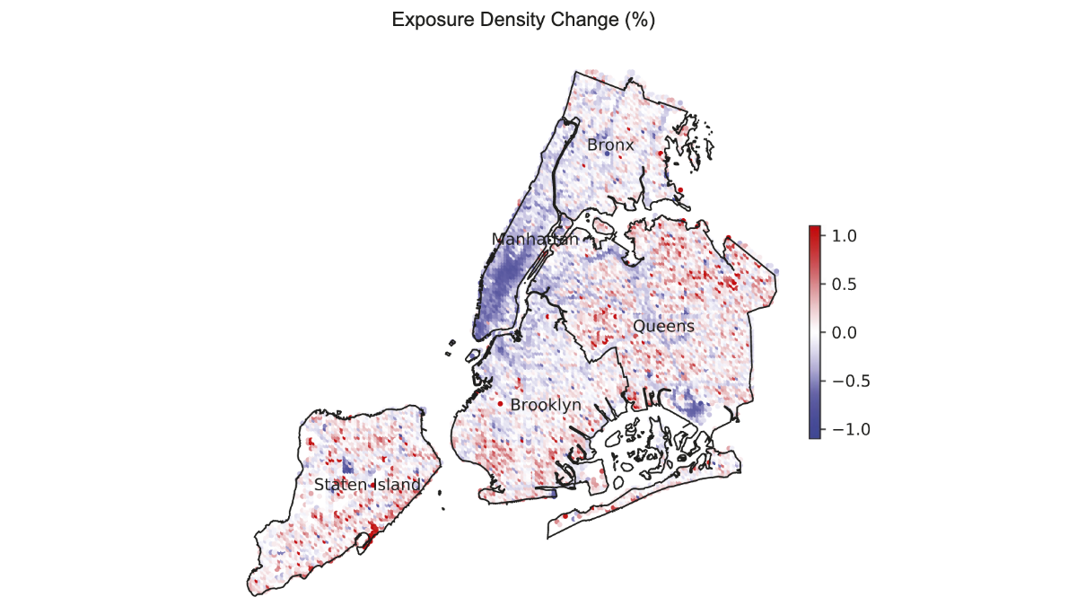
Exposure density and neighborhood disparities
in COVID-19 infection risk
Paper
/ Feb 24,2020
Validating the Use of Wi-Fi Signals
to Estimate Hyperlocal Urban Population
Paper
/ Dec 17,2018
Quantifying place
Analyzing drivers of pedestrian activity in dense urban environments

Paper
/ Nov 30,2018
Digital footprints
Using WiFi probe and locational data to analyze mobility trajectories

Paper
/ Jul 20,2017
Urban phenology
Toward a real-time census of the city using Wi-Fi data
Featured Posts
View all posts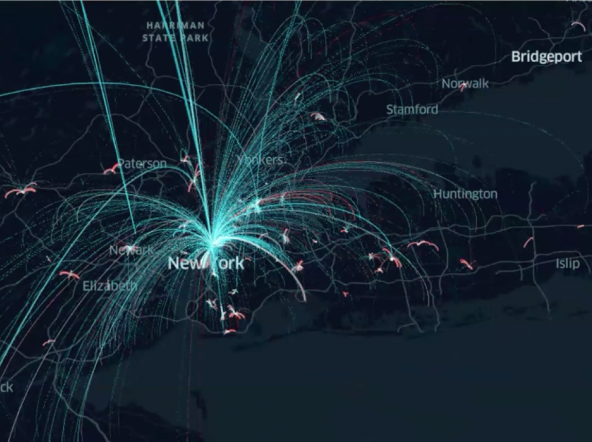
Mar 21,2025
Constantine Kontokosta Speaks
on Commuting Patterns During and After the Pandemic Period

Aug 28,2024
Constantine Kontokosta Awarded NSF Grant
to Examine Interconnectedness of Residents from Varied Neighborhoods
Jul 26,2023
Marron Researchers Study the Impact of Remote Work
Jun 06,2023
Marron Research Presented
to the National Bureau of Economic Research

Jan 20,2023
Constantine Kontokosta and Solly Angel
Receive Seed Funding to Study Mobility Patterns and Use of Space
Sep 08,2022
Civic Analytics Team to Present At APPAM
Apr 23,2021
Civic Analytics New Research on Resilience
Measuring Inequality in Community Resilience to Natural Disasters
Aug 04,2020
Exposure Density and Neighborhood Disparities
in COVID-19 Infection Risk

Apr 28,2020
NSF RAPID Awarded to Team Led by Kontokosta
Featured Press Posts
View all press posts
Scientific American
Press
/ Sep 18,2020