Related
Apr 08,2014
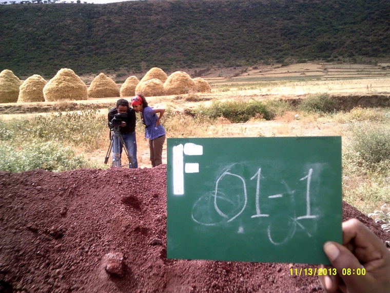
Urban Expansion: On the Ground in Ethiopia
Feb 19,2014
The NYU Stern Urbanization Project recently partnered with the Mahatma Education Society (MES) and the Infrastructure Development Finance Corporation Institute (IDFC) to establish the India Urban Expansion Observatory (UXO). The UXO is in Navi Mumbai (New Mumbai), the area of the Mumbai metro region that is expected to absorb most of the growth in region over the next 25 years. Navi Mumbai currently has around 7 million people but lacks major infrastructure links to Mumbai proper (old Mumbai). As a result, much of the growth in the Mumbai region has continued to take place inside and immediately adjacent to the old city. In particular, open spaces have been occupied and large, extremely dense slums have arisen.
It’s fitting, then, that the UXO is located in Mumbai. The project aims to monitor the quality of spatial layouts and the distribution of land uses in a representative global sample of 200 cities. It focuses on the growth areas - places that have developed from 1990 - 2000 and 2000 - 2010. The project will also provide information on the amount of land occupied by arterial roads in these cities and access to these roads - roads that can carry trunk infrastructure and major public transportation (like Bus Rapid Transit).
The UXO is housed at the Pillai College of MES. They’ve provided an entire floor in a new wing of their New Panvel campus, and have outfitted it with equipment and desks, air conditioning and backup power, and large wall maps showing the cities that we’ll be monitoring. The IDFC is overseeing the project on the ground.
Pritika Hingorani of the IDFC, Priam Pillai of MES, and I conducted interviews over several days in December and hired a team of 12 analysts and 2 supervisors to do the work. It’s an all-India team and the members have backgrounds at IITs, regional technical universities, and even international institutions. Manuel Madrid, a GIS expert who worked with us at NYU in developing the procedure for analyzing satellite imagery of the expansion areas, visited in early January. He and I conducted a training of the analysts and supervisors in our specific technique, which involves looking at 10-hectare areas within the locales and digitizing blocks, roads, and land uses.
The UXO will be working for the next 14 months, analyzing over 14,000 of these 10-hectare areas. At the end, we’ll be able to say for the first time ever how land is being used in the expansion areas of cities around the world. This work will be presented at the United Nations Human Settlements Conference in mid-2016, officially launching a new way of monitoring progress in cities.
On Jan 10th, we held a launch event in New Panvel that was attended by the head planners of Navi Mumbai, the head of technical education for the state of Maharashtra, and other luminaries. Members of the press were also in attendance. You can see some coverage in the Hindustan Times and DNA Info.
Please fill out the information below to receive our e-newsletter(s).
*Indicates required.